RadarTechnology
Capabilities
Array Labs designs, builds, and operates the world’s most advanced radar systems - delivering up to 100x the power of legacy solutions at a fraction of the cost.
TurnkeyRadar Sensors
Array Labs’ modular radar systems provide superior power, flexibility, & performance, supporting a wide variety of radar applications.
High performance, cost-effective, & mission ready sensors designed to integrate seamlessly with any satellite.
Synthetic Aperture Radar
Capture high-resolution imagery anywhere in the world – independent of daylight or weather.
- Offers consistent, gap-free imaging for time-series analysis and predictive modeling.
- Integrates seamlessly with AI pipelines for automated object detection and pattern recognition.
Space Domain Awareness
Detect, track, and monitor satellites and debris, increasing the safety and security of space operations.
- Instantly measure the position, velocity, and acceleration of any object.
- Reliably track objects across any orbit, at any time, independent of lighting conditions.
Moving Object Identification
Wide-area, real-time MTI operations across ground, maritime, and airborne environments.
- Respond to rapidly evolving situations with software-defined, multi-modal radar sensors.
- Provide persistent detection and tracking from a survivable orbital platform.
MultistaticRadar Systems
The first radar satellite constellation optimized for distributed operation, enabling higher performance, greater coverage, and advanced operational modes like single-pass 3D imagery and real-time MTI.
MultistaticRadar Systems
The first radar satellite constellation optimized for distributed operation, enabling higher performance, greater coverage, and advanced operational modes like single-pass 3D imagery and real-time MTI.
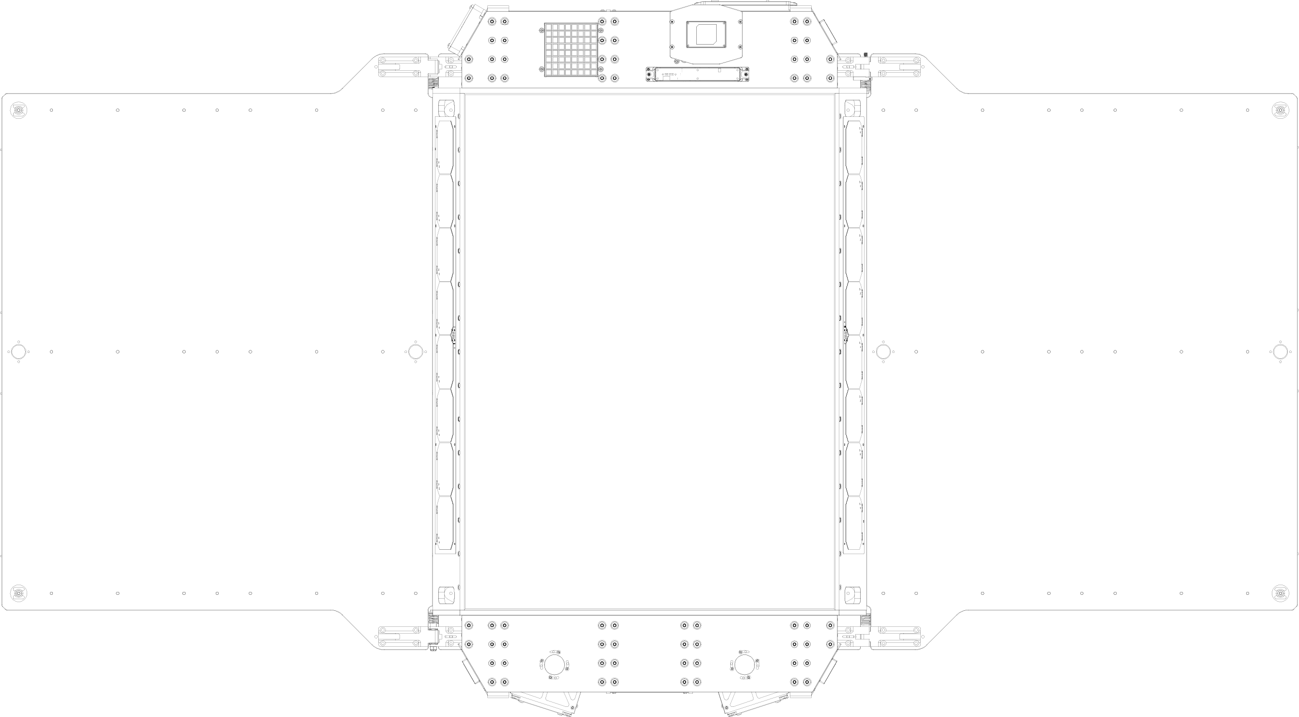
Our Satellite Design
Optimized for formation flight and cooperative imaging, our radar satellites pack unparalleled power and performance into a compact, rapidly deployable form factor.
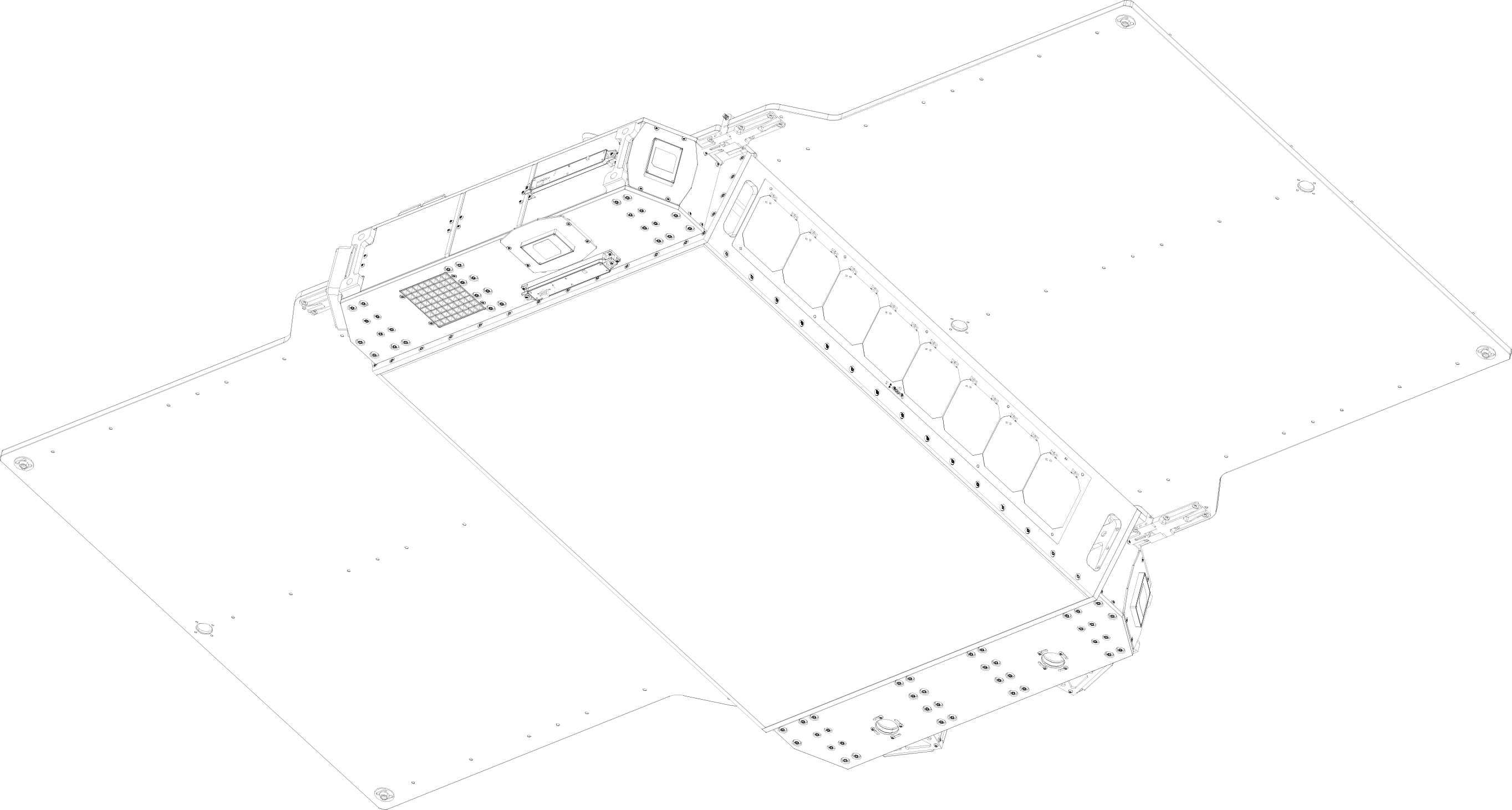
Purpose-Built Fleets
Building upon a modular architecture, our satellite clusters scale seamlessly in size and power—delivering configurable coverage, resolution, and performance for any mission.
DigitalElevation Models
Our multistatic radar clusters are capable of collecting precise 3D imagery in a single pass, rapidly delivering wide-area, high-resolution elevation data that can be rapidly and easily integrated into workflows, systems, and operations.
Navigation & Localization
High-resolution 3D imagery provides foundational data for precise positioning and reliable navigation for autonomous systems, even in GPS-denied environments
- Robust localization in GPS-denied areas
- Precise 3D mapping for safe path planning
- Real-time positional updates
Line Of Sight Analysis
Accurately assess visibility, coverage, and obstruction for any point on Earth, enabling rapid RF propagation studies & network modeling
- Evaluate terrain-based visibility and blind spots
- Model RF coverage and signal propagation paths
- Identify obstructions impacting network
Slope & Volume Measurement
Rapid, precision topography measurements support real-time slope, grade, and volume monitoring for terrain analysis, construction, and resource management
- High-accuracy slope & grade detection
- Real-time cut/fill volume calculations
- High-density terrain mapping & reporting
Industries
Physical AI
Supplying the spatial intelligence needed for real-world autonomy—enabling better planning, resilient design, and optimized deployment from aerial drones to ground robots and self-driving vehicles.
Infrastructure
Supporting the design, construction, and maintenance of global infrastructure—from roads and cities to utilities and telecom—through precise, scalable 3D terrain data to enable better planning, resilient design, and optimized deployment.
Industrials
Empowering industrial operations with high-resolution terrain models for planning, monitoring, and decision-making at planetary scale.